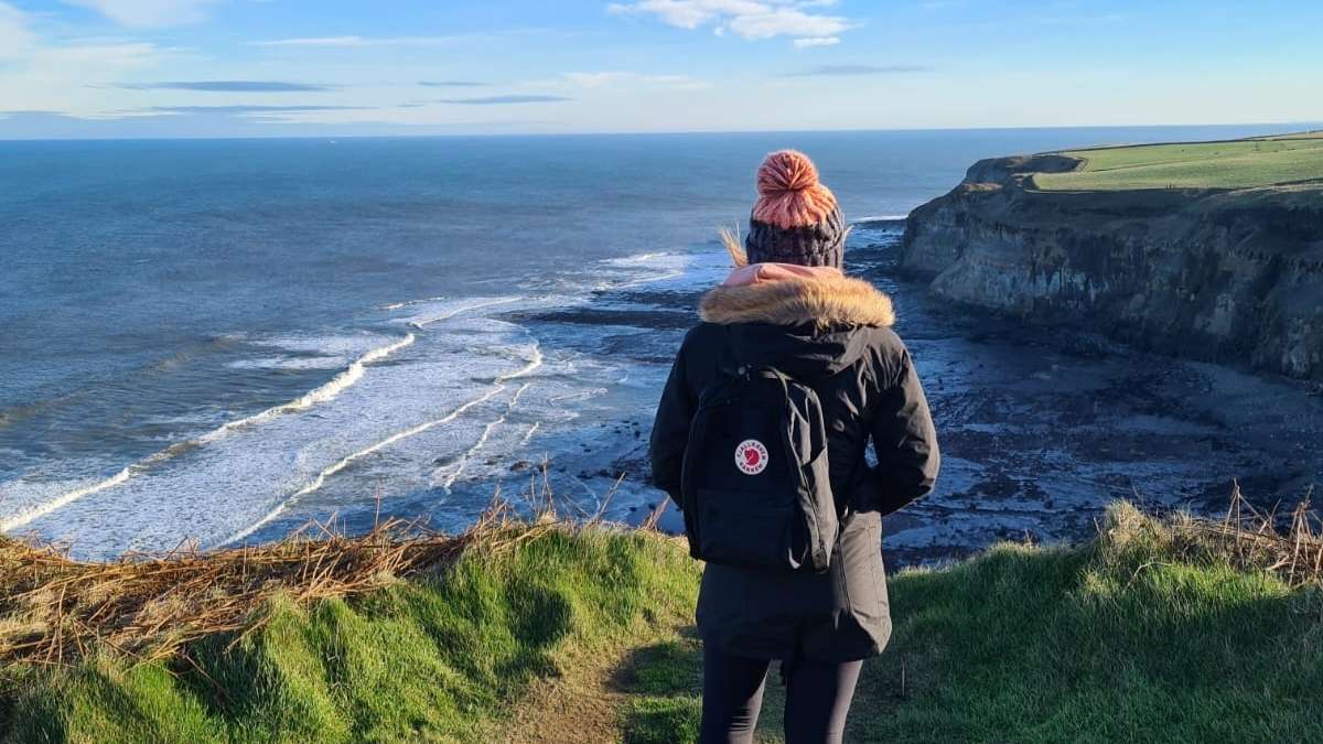
People flock to the Yorkshire Coastline, known for its dramatic cliffs, vast landscapes and unforgettable walking routes. Here are 8 of our favourite Yorkshire Coast Walks you have to try.
There are many walks to admire the Yorkshire Coasts' rugged landscape, pretty seaside towns, and traditional fishing villages. With the Cleveland Way walking route from Saltburn to Filey and plenty of places to stay along the way, there is nothing quite like a walk along the Yorkshire Coastline. It is a unique part of the UK and a place we love to visit as much as possible. We have chosen 8 walks along the Yorkshire Coastline that offer varying landscapes and spectacular cliff views so that you can make the most out of your next trip.

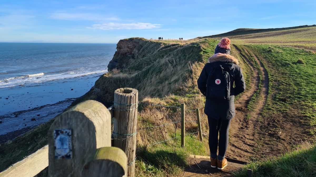
1. Walk from Whitby to Scarborough along the Cleveland Way
21 miles (34 km) | Takes two days | Difficult, great for those who want to see the entire coastline

Whitby Mini Guide
We have created a FREE mini-guide with all the essential information about Whitby, now available for instant download.
This is the most magnificent coastal walk in the UK. So if you fancy challenging yourself and want to admire every inch of the Yorkshire Coastline, this walk is for you. We suggest giving yourself two days to complete this route. This walk follows parts of the Cleveland Way, takes you to Whitby Abbey, Robin Hood's Bay and Scarborough Castle and has a few challenging climbs along the way.
Pass Hayburn Wyke Nature Reserve
On this walk, you will pass many beautiful places, such as Robin Hood's Bay, Ravenscar and Hayburn Wyke Nature Reserve. This nature reserve is a hidden cove backed by ancient woodland. The beach is a gem with magical woodland trails and a pretty waterfall. You should stop for lunch and refreshments, especially at the Hayburn Wyke Inn. The Inn is set on 10 acres of gorgeous grounds, with plenty of outside seating and gardens to enjoy all year round.

I have a moderate fitness level, and found this Yorkshire coast walk is very challenging. However, the incredible coastal views, constant feeling of peace, and wildlife galore make this walk so perfect. It's an outstanding achievement and an exceptional route you won't regret taking.
You can find more information and the entire walking route here.
2. Walk from Whitby to Sandsend
3 miles (4.8 km) | Takes roughly 1 hour | Easy, great circular walk if you are staying in Whitby
This popular walking route is easy and an excellent way to explore the beaches near Whitby. There are two options for this walk, which are roughly 3 miles long. You can walk along the promenade and the beach the entire way when the tide is out. Or you can walk along the path and clifftop if the tide is in. You can make this a circular walk, along the beach and back via the path route or vice versa.
This walk is perfect for incorporating into your day exploring Whitby, but if you fancy going further, you can extend your walk to Mulgrave Woods. The woodland here is filled with trails, waterfalls and the ruins of Mulgrave Castle. You could even continue along the Cleveland Way and visit Runswick Bay.
Sandsend
Sandsend is a lovely fishing village with a beach fantastic for rock pooling and fossil hunting. If Whitby feels crowded, Sandsend is a great place to find peace. There are some great places to get food in Sandsend. The Hart Inn is the cosy local pub, and Etsbek House is a great restaurant. They both use locally produced ingredients, especially fish. Several Sandsend Pubs also serve delicious homemade food.
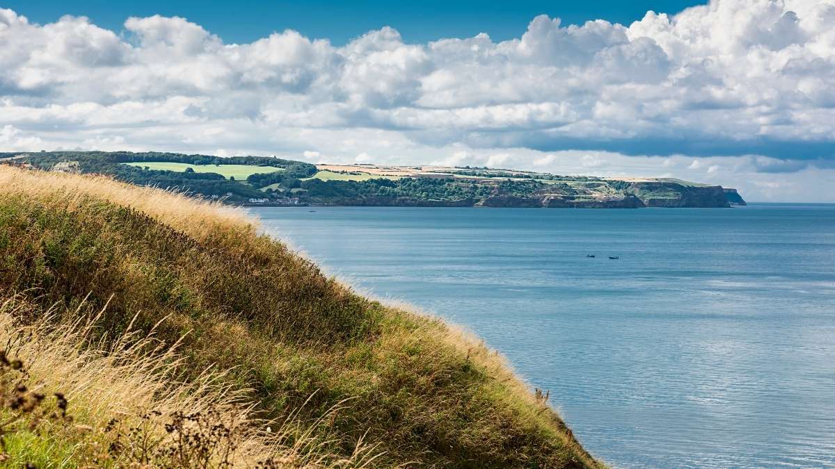
3. Walk the Ravenscar to Robin Hoods Bay Circular Route
11 Miles (17.7 km) | Takes 6 hrs 30 mins | Difficult, great for those who love wildlife and bird watching
This 11-mile walk takes you from the soaring heights of Ravenscar across Howdale Moor. Then down to the old Scarborough to Whitby line and finally along to Robin Hood's Bay. This is one of our favourite walks because it features a variety of things to do along the way, such as visiting Boggle Hole, rock pooling, beach combing and fossil hunting and experiencing the Cleveland Way National Trail and the Cinder Track.

This walk is certainly not for the fainthearted! It is long and can be challenging in parts. There are steep descents and ascents, especially as you reach Boggle Hole. It gets slippy, too, so please wear appropriate footwear and take caution. Due to the location, the weather here often changes rapidly and can cause poor visibility too.
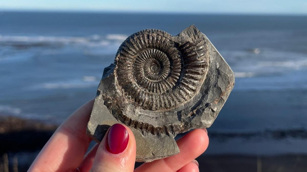
Boggle Hole
Boggle Hole is worth a visit on this route; it is a small cove that the harsh North Sea has worn away. Many people believe that Boggles live in caves like this across the North Yorkshire Coastline. It is said that these boggles had magical healing powers. People also used the caves along the coastline to hide their smuggled contraband, such as rum and tobacco. Today, you'll probably find fossil hunters and people exploring the cave. It is a fascinating place to explore and has a rocky foreshore where many fossils, such as belemnites and ammonites, can be found. The beach here is dog friendly.
You can find more information and follow the entire route here.
4. Walk from Whitby to Staithes
11 miles (18.5 km) | Takes 6-7 hours | Difficult, great for those who want a full days walk
The route is a full day's walk; therefore, you will need comfortable walking boots! This walk starts at Whitby Abbey, where you head northwest to Sandsend. This route shows off the beaches in and around Whitby. You quickly pass Whitby Sands, where you can spot the famous coloured beach huts and get some fantastic photos.
This walk also takes you on a detour through Mulgrave Woods, where you can follow woodland trails and explore the ruins of Mulgrave Castle. Next, you will continue past Kettleness, a remote cove just east of Runswick Bay. Before going through Hinderwell and Port Mulgrave, you will pass Rosedale Cliffs until you arrive at Staithes. We love this walk as it incorporates woodland, sea views and pretty coastal towns.
Port Mulgrave
The quaint Port Mulgrave is located between Staithes and Runswick Bay in the civil parish of Hinderwell. It once homed an ironstone mine/exporting port, and you can see rows of miners' cottages still there today. Port Mulgrave is a popular location for collecting fossils. If you look carefully, you can find a range of ammonites, dinosaur or reptile remains and even jet. However, checking the tide times is essential if you plan on giving it a go; it is easy to get cut off at Port Mulgrave.

Staithes
You can't find a more charming and traditional fishing village on the North Yorkshire Coast than Staithes. Just 10 miles from Whitby, Staithes was one of the busiest fishing ports along the coast and boasted a long, proud history as the former home of famous Royal Navy captain and explorer Captain James Cook.
You can find more information and follow the entire route here.
5. Walk from Whitby to Robin Hood's Bay
7 miles ( 11 km) | Takes 3 – 4 hours | Moderate, great for incredible cliff-top views
This is one of the most popular and scenic Yorkshire coast walks that you can enjoy. You will certainly have earn't you your fish and chips by the time you arrive in Robin Hood's Bay and in our case, a few well-deserved beers too. This walk is approximately 7 miles, and although it only takes 3-4 hours to complete, it is considered a moderate walk due to its inclines and declines. Nevertheless, this is one of our favourite routes. Don't worry; there are many places to stop and enjoy a picnic along the way.
This walk takes you along part of the Cleveland Way, which stretches from Scarborough and loops the entirety of North York Moors National Park. The walk begins opposite Whitby Abbey, where you join the Cleveland Way National Trail. You then follow it south towards Robin Hood's Bay.
It's a tiring route but rewards you with breathtaking views. It is well-signposted and easy to follow. Walking boots/ the correct footwear is essential. If you are up for even more of an adventure, you can continue down the coast to Ravenscar. You can also make this a circular route (if your legs will take you!) and return the way you came or follow the Cinder Track to Whitby.
We often see many people walking dogs via this route; however, we suggest keeping them on a lead at all times and not taking dogs you cannot control. The sheer drop you are walking alongside occasionally has broken parts in the fencing, and we did once see a dog get very close to the edge with some panicked owners.
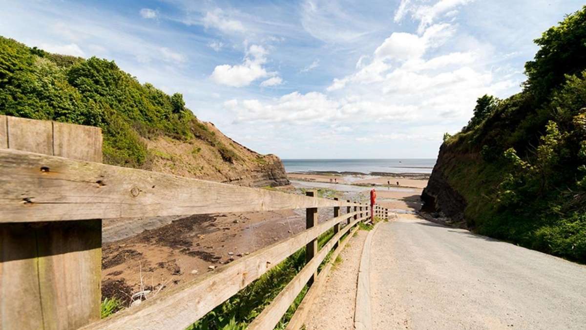
Saltwick Bay
On this route, you quickly reach Saltwick Bay, just across from Whitby Holiday Park. You can get down to the bay here. Just take care of the steep path and check the tide times. It's a fantastic spot for fossil and jet collecting and visiting the wreck of Admiral Von Tromp.
Robin Hood's Bay
We love to spend time at Robin Hood's Bay. It is a great place to stay, too, especially after walking, hiking, cycling, and exploring all the history the area offers. It has plenty of places to stay, things to do, restaurants and pubs, and a whole lot of history. Please look at our guide to spending a week in Robin Hood's Bay here.
You can find more information and the entire walking route here.
6. Walk from Whitby to Runswick Bay
7 miles ( 11 km) | Takes 3 – 4 hours | Moderate, great for incredible clifftop views
This popular clifftop walk takes you from Whitby to Runswick Bay. Our top tip for this route is to take a flask of tea and a small picnic so you can stop and fully appreciate the views along the way. The walk between Runswick Bay and Whitby is a fine example of England's best coastal walking views.
This clifftop route begins at Whitby Sands beach with its coloured beach huts. This walk first takes you to Sandsend. You can divert off the path to visit Mulgrave Woods and incorporate a woodland walk into this route. You then continue to Sandsend Ness; this area dates back to the 17th century and is an old alum quarry.

Runswick Bay
Compared to Whitby, Runswick Bay is a much smaller fishing village. It is known for its sheltered bay, quaint beach and glistening red-roof cottages. The Times and Sunday Times Travel recently named Runswick Bay Britain's best beach in their top 50 round-up of the country's best beaches. So why not stop and enjoy refreshments at one of the many cafes or hotels with lovely views over the bay?
You can find more information and the entire walking route here.
7. Walk the Flamborough Head Circular Route
2.5 miles ( 4 km) | Takes roughly one hour | Easy, great for children and wildlife spotting
This circular route is a great walk to get you started exploring the Yorkshire Coast. It's a popular route with bird watchers and hikers. The trail is open year-round and is beautiful to visit anytime. We love this route as it's short enough to fit into a jam-packed day exploring the coastline. It's excellent for children, and if you are lucky, you might spot seals. However, it can get muddy and slip in parts, so please take care and wear appropriate footwear.

Flamborough Headland Lighthouse
This walk begins at the lighthouse by the Flamborough Headland information board. The old Flamborough lighthouse was built on Flamborough Headland in 1669 and was not lit. You can visit today's new lighthouse, which was built in 1806. It is a waypoint for deep sea vessels and coastal traffic. It marks the Flamborough Headland for traffic heading for the ports of Scarborough and Bridlington.

Coastal Wildlife, Seabirds
One of the many reasons we love to visit Flamborough is for the 122m chalk cliffs and to witness the largest mainland seabird colony in the UK. Here you are almost guaranteed to see gannets, puffins, kittiwakes, and razorbill; you're even more likely if you visit during the breeding season. More than 400,000 birds swarm around the cliffs from April to August, and the skies are alive with puffins, gannets and guillemots.
You can find more information and the entire walking route here.
8. Walk the Glaisdale and Egton Bridge Route
5 miles (8 km) | Takes 3 hours 30 minutes | Easy walk, great for history lovers
One of our favourite woodland walks, it runs between Glaisdale and Egton Bridge and takes you through the Esk Valley countryside. It's a walk bursting with history as you wander along ancient stone trods, over Beggar's Bridge and through pretty bluebell woodland.
The high farmland on this walk offers excellent views. You can easily access this walking route via train. Glaisdale, where this route begins, and Egton Bridge are stops on the Esk Valley Railway. The walk follows field paths and woodland tracks; there are a few steep climbs and stiles along the route, so please take care and wear appropriate footwear.

Beggars Bridge
This walk is a great way to incorporate a visit to Beggars Bridge, known for its romantic tale. There is an inscription on the bridge reading 1619 TF, which refers to Thomas Ferries, the son of a moorland farmer. Here he would meet his love, Agnes, but her father believed Thomas was too poor to marry his daughter. So Thomas went to sea to seek fortune, but before he left, he could not kiss his love goodbye as the river had flooded. He returned home years later to a wealthy man, married Agnes and built Beggars's Bridge.

Monks' Trod
This route also takes you along trods, ancient pathways paved with stone slabs. They are common across the area and date back to the 17th and 19th centuries. For example, the Monks' Trod is a stone trod near Egton Bridge which could have been a path to the site of St Hilda's Church. Now a mortuary chapel, the Church was dismantled in 1871.
You can find more information and the entire walking route here.
Cleveland Way, 109 miles (175 km)

The Cleveland Way National Trail is a walking route officially opened on 24th May 1969. It is featured in many walking routes along the Yorkshire Coast, and anyone can walk the Cleveland Way with a reasonable fitness level. However, the route gets steep and challenging, so make sure you plan a walking trail that is suitable for you.
The Cleveland Way starts from the pretty market town of Helmsley, and most people choose to walk the route in a clockwise direction from Helmsley to Filey. Walk the route clockwise (This usually puts the wind behind you!) But there is no right or wrong way, and plenty of people enjoy walking the route in the opposite direction.
Cinder Track, 21 miles (33.7 km)

The Cinder Track is a path that runs on the old railway line that closed in 1965. The Cinder Track provides an off-road route for cyclists and walkers along a significant part of the North Yorkshire coast. It can be started from Whitby and end at Scarborough or started at Scarborough.
It is bursting with history, fantastic views, secluded coves and access to local attractions, including Scarborough Castle, Whitby Abbey and the Captain Cook Memorial Museum. If you are super fit, you can complete the entire track in two days; however, many walking routes also include parts of the Cinder Track.
Let us know in the comments if you have tried any of these Yorkshire Coast walks. There are so many walking routes along the Yorkshire Coast; this is a selection of our favourites we hope have inspired you to try on your next trip.


Related Posts